Recent posts

Daily rainfall datasets (CHIRPS) in Google earth engine (GEE)
Daily rainfall datasets (CHIRPS) in Google earth engine (GEE) var dataset = ee . ImageCollection ( 'UCSB-CHG/ CHIRPS…

Use of GIS in modern Hazard management
Use of GIS in modern Hazard management Geographic Information Systems (GIS) are powerful tools for collecting, storing, a…

Generative AI in GIS: A New Frontier for Spatial Analysis
Generative AI in GIS: A New Frontier for Spatial Analysis Generative AI is a branch of artificial intelligence that focuse…
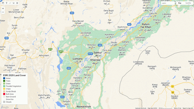
Rapid water inundation and submerged crop fields mapping using satellite remote sensing
Rapid water inundation and submerged crop fields mapping using satellite remote sensing Floods have utterly destroyed Paki…

Cartography/Map Composition in QGIS
Cartography/Map Composition in QGIS OBJECTIVES: - To do Cartography in QGIS on given data set. Cartography (from Gre…


Social Plugin